


“VISION FOR THE FUTURE OF LANGLEY
The City of Langley maintains its small town historic charm and unique sense of place that is characterized by the convergence of beautiful and inspiring natural and built environments. The city continues to be vibrant, artistic, human-scaled and walkable and supports social and cultural connections amongst locals and visitors. Due to these assets, Langley continues to be the artistic, cultural, retail, service and entertainment center for South Whidbey, attracting visitors, retirees, businesses and new families to the community.1/3/2018 page 2.
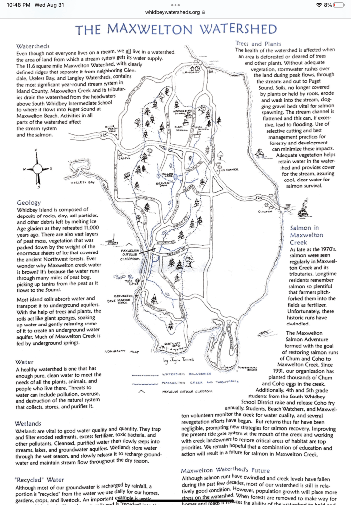
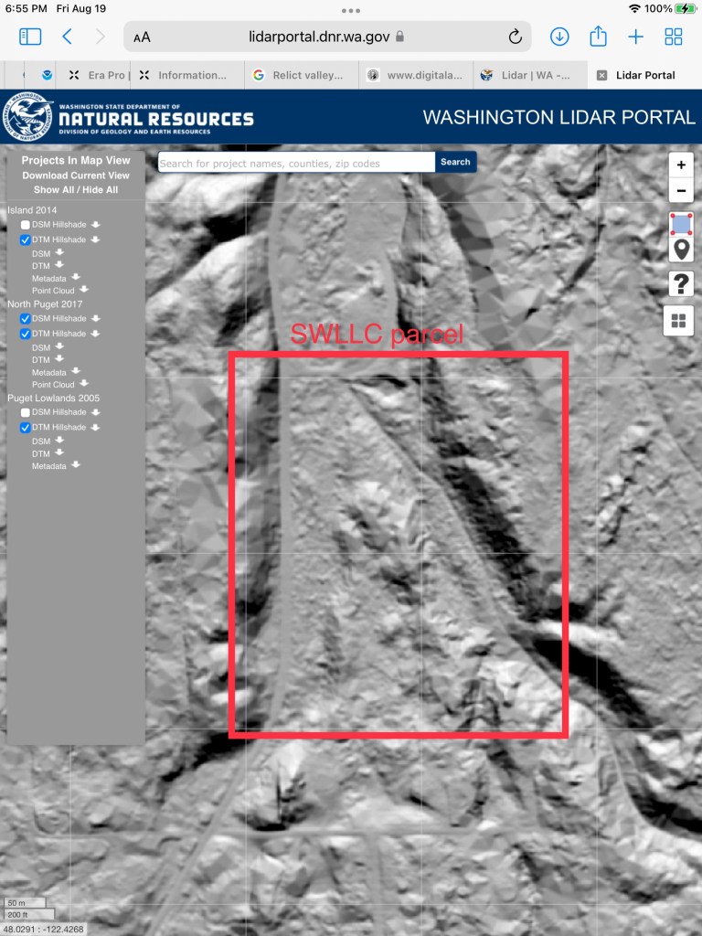
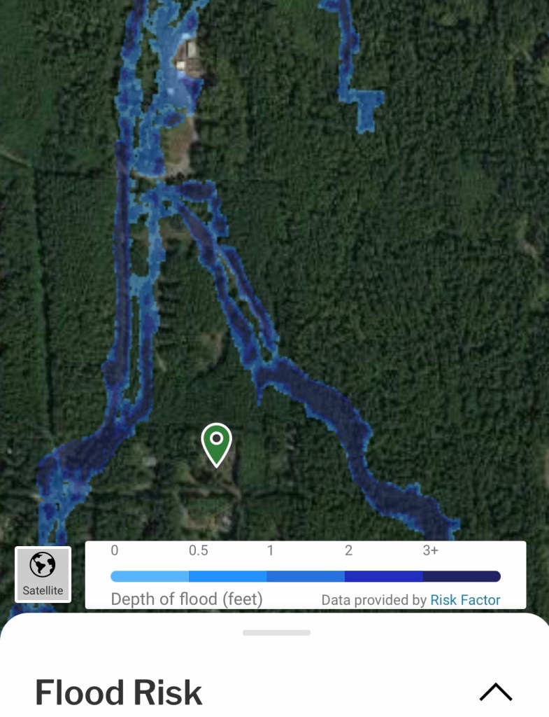
The shape and character of Maxwelton Creek is constantly changing. Rain and wind cause floods and blow new trees down into the creek to divert water flow in new directions. In the winter of 1996, torrential rains caused floods so high that water was flowing across Erikson Road near the Outdoor Classroom site. Some salmon were observed swimming across the road!
Whidbey Watershed Stewards began as an organization committed to educating young people about their homes on Whidbey Island. Quickly, we realized that the home we all share is in trouble — and the legacy that we are passing on to our children is missing some important components. We began our restoration and research programs to return those missing pieces of our ecosystem to the island. Through actions big and small we work toward providing a healthier, more resilient place to live where our children will be able to swim in the water, eat the shellfish, and fish for salmon.
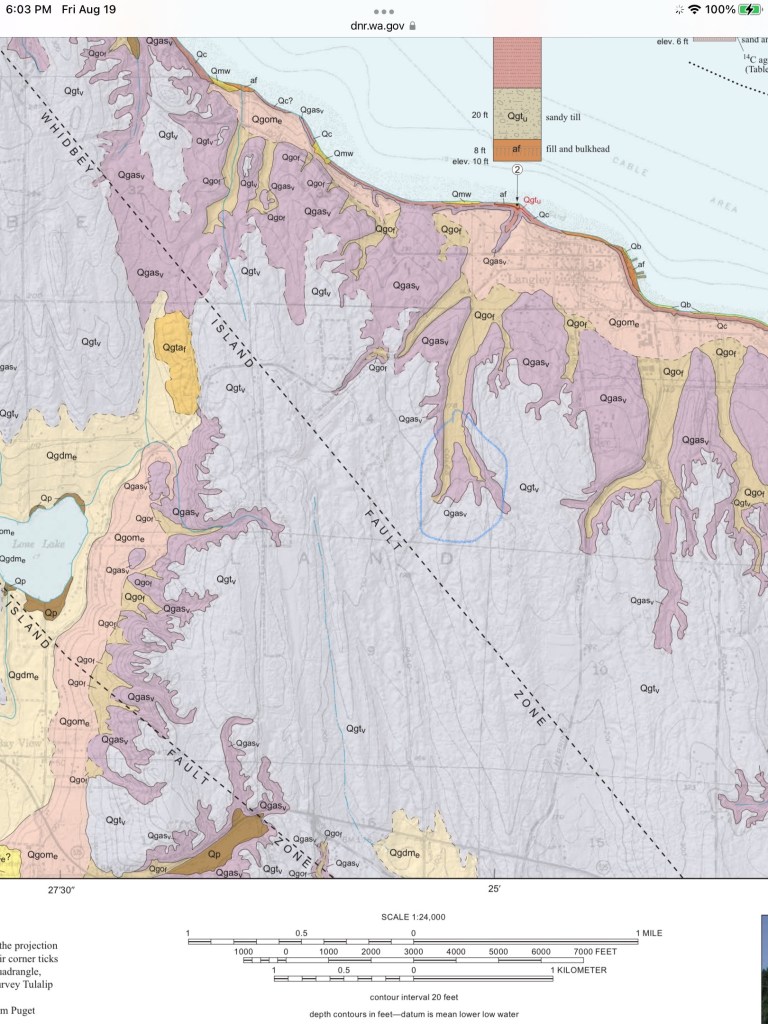
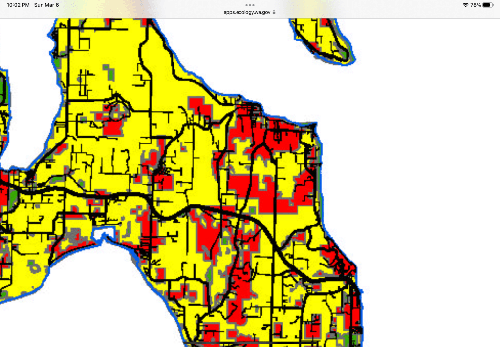
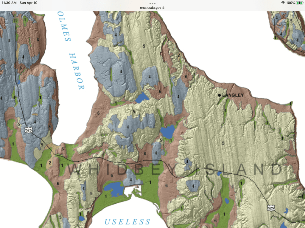
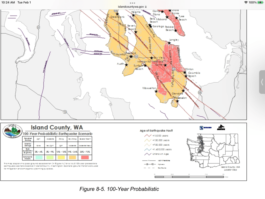
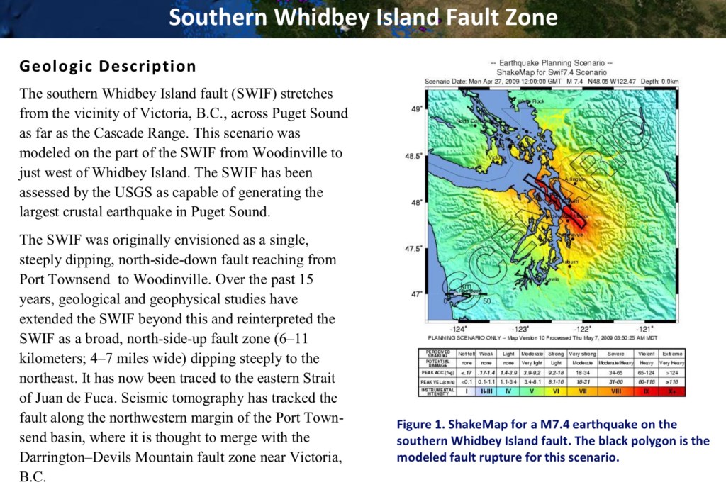
Map is soil geology of Langley and development area. WA DNR image shows the sandy glacial valleys (light brown Qgof) and uplands. The South Whidbey EQ fault is .25 miles from SW corner of development. Soil is same as the wetland, sand and Norma silt loam. The type of soil is known for liquefaction. Paleoseismology: Radiocarbon and stratigraphic data collected from sites on either side of the SWIF on Whidbey Island showed that the sea-level histories of the two sites were not comparable. Instead, the relative sea-level curves diverged 3,200 to 2,800 years ago, suggesting 1 to 2 meters of uplift along the north side of the fault. This suggests the fault has been active in the past. Based on these calculations, researchers concluded that the SWIF is capable of producing a magnitude 6.5 to 7.0 earthquake.
Liquefaction: If sediments (loose soils consisting of silt, sand, or gravel) are water-saturated, strong shaking can disrupt the grain-to-grain contacts, causing the sediment to lose its strength. Increased pressure on the water between the grains can produce small geyser-like eruptions of water and sediment called sand blows. Sediment in this condition is liquefied and behaves as a fluid. Buildings on such soils can sink and topple, and foundations can lose strength, resulting in severe damage or collapse. Pipes, tanks, and other structures that are buried in liquefied soils will float upwards to the surface.
Artificial fills, tidal flats, and stream sediments are often poorly consolidated and tend to have high liquefaction potential.
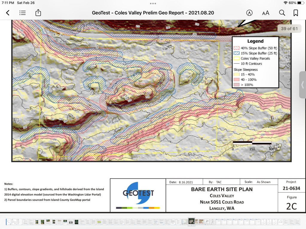
Landslides: Earthquake shaking may cause landslides on slopes, particularly where the ground is water- saturated or has been modified (for example, by the removal of stabilizing vegetation). Steeper slopes are most susceptible, but old, deep-seated landslides may be reactivated, even where gradients are as low as 15%. Catastrophic debris flows can move water- saturated materials rapidly and for long distances, mostly in mountainous regions. Underwater slides are also possible, such as around river deltas
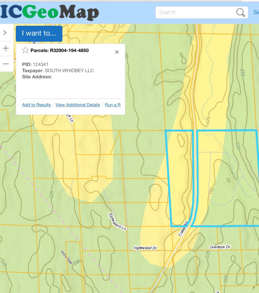
Yellow area SWLLC parcel is moderately susceptible to liquefaction. Development in this area must conform with EQ standards. Proposed plan has a majority of the ‘subsidized housing’ in this area.

A page from the original development agreement with buffers, removal of vegetation within buffers prohibited except for trails/walkway. Bob Libold, NJB Development (Pacific Crest Partners and SWLLC), was involved in the negotiations for the 2005 annexation and “The Grove” development approval.
